 Long after the original wanderings of Australia’s indigenous inhabitants, Europeans began to rediscover the vast Australian landscape. These monumental overland treks are now part of white man’s folklore as much for their audacity and bravery as their sheer foolhardiness.
In 1861, Burke and Wills staggered north into oblivion while Ludwig Leichhardt vanished in the middle of the country in 1848. However, one Englishman stands out as an accomplished explorer with an enviable, if unusual record of achievement. In 1840, soon after the formation of the colony of South Australia, Edward John Eyre gathered a large party and set out from Adelaide to cross the continent to Western Australia.
Unlike Burke and Wills, Eyre recognised the value of Aboriginal guides and many would argue his success was a direct result of their ancient bush skills. Just he and one trusted guide, Wylie, eventually completed the journey after four and a half arduous months. None too impressed, he described the land as "a hideous anomaly, a blot on the face of Nature, the sort of place one gets into in bad dreams".
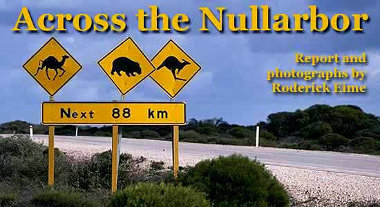
Today, the vast and foreboding Nullarbor Plain (named so because of its lack of trees) is criss-crossed daily by aircraft, trains, coaches, enormous trucks and humble holidaymakers alike.
After five years of difficult toil, the Trans-Australian Railway was completed in 1917 creating the first land route between Adelaide and Perth. In the typical short-sightedness of the time, the gauge matched neither at either end of the line, so it wasn’t until 1970 that the entire line was converted to match. The Indian Pacific’s 64 hour transcontinental crossing is now recognised as one of the truly iconic railway journeys of the world.
The railway line was still a novelty when, in 1919, Captain (later Air Vice-Marshal) Henry Wrigley flew a flimsy BE2 biplane across the continent. Today, for a few hundred dollars, anyone can travel the entire breadth of the country in jetliner comfort in a matter of hours.
Yet even with the oversupply of easy and economical options, many diehard and intrepid travellers choose to traverse the land by road using the national highway that so appropriately bears the name of the first European to do so, Edward John Eyre. The land route is the one that defines this journey, described by some as a pilgrimage, since it examines firsthand some of the hardships and deprivations endured by the tough pioneers who forged the corridor.
In 1877, a telegraph line was created between Adelaide and Albany, a feat that mirrored Eyre’s 35 years before and repeater stations were constructed along the route. Many still stand today, while others are crumbling ruins. The former station at Eucla is probably the best known as it appears and disappears again beneath the shifting sands and has been the subject of many moody photographs. Eyre station, near Cocklebiddy, is now the site of a bird observatory and weather station and is occupied year-round.
The telegraph line was eventually moved up along the railway in 1927 to avoid the hungry dunes and with the outbreak of the Second World War, the need for reliable roads became imperative. In 1941, a continuous road was built in just six months by 150 men deemed too old for military service. The straight dirt road replaced a series of winding tracks and soon saw increased traffic and as the newly mobile post-war nation went about exploring their country. Breakdowns were frequent and motorists were often stranded for days on end as spare parts gradually caught up with them.
In 1976 the highway was sealed end-to-end and the floodgates opened. Travellers, road freight and tourist buses quickly became commonplace on the flash new surface. Road stops expanded, motels appeared and new levels of service gradually sprung up catering to an affluent population eager to enjoy the very wide open spaces.
Planning a trip across the Nullarbor is straightforward. Make sure your vehicle is fully checked for roadworthiness; in particular tyres, cooling system, engine and steering. Trips of this length are best shared with two or three drivers and allow four or five days to complete it safely and fully enjoy the many highlights along the way.
For example, surfers will be well aware of the locations between Ceduna and Fowlers Bay that are legend amongst board riders. Cactus Beach, a rough twenty kilometres south of Penong, is probably the best known of them all and it is quite common to see the sun-bleached wave hermits camped among the dunes behind the breakers.
Land-based whale watching is a unique feature of the South Australia sector. At the Head of Bight (the most Northerly extent of the Great Australian Bight) up to sixty extremely rare southern right whales calf and mate from May until October and are visible from the Twin Rocks Lookout.
Sections of the old dirt highway still remain and to truly understand the tribulations facing earlier travellers, why not drive a few kilometres along the dusty path?
The spectacular Bunda Cliffs stretching between Nullarbor and the Border Village are without doubt one of the highlights of the journey. These incredible geological features were created some 50 million years ago and are composed of limestone laid down when the Nullarbor Plain was once an ancient seabed.
After crossing the Western Australian border the arrow straight road drops down onto the Roe Plains, frequented by Wedge Tailed and Sea Eagles nesting in the nearby cliffs bordering the Hampton Tablelands. Mundrabilla revels in rumours of alien and UFO sightings, but one thing is known for sure. In 1966 one of the most famous meteorite finds were made north of the highway.
Continuing the space theme, large, flaming chunks of Skylab plummeted from the heavens in 1979 landing near the ruins of Balladonia station, while beneath the hard, ancient surface extensive limestone caves can be carefully explored.
Yet above all, the drive across the Nullarbor is a genuine adventure and for many it is a lifelong ambition. It typifies the most inhospitable country our 19th century pioneers faced and is a mind-boggling reminder that for tens of thousands of years, the resilient indigenous people made this region home, thriving in its scarcity.
To challenge – and conquer – the Nullarbor is to live the Australian outback experience.
~~~~~~~~~~~~~~~~~~~~~~~~~~~
Ancient Times
Aboriginal presence on the Nullarbor can be traced back as far as the earliest evidence of human settlement. The Pitjantjatjara, whose domain extends as far north as Ulurua are a prominent group, as are the Wangai, who earned respect for assisting early prospectors and miners, especially around the towns of Coolgardie and Kalgoorlie.
The whale watching point at Twin Rocks is on Yalata Aboriginal Land and permits are required before venturing off the highway. The community is located near the namesake roadhouse.
Fast Facts
The Eyre Highway extends from Port Augusta in South Australia to Norseman in Western Australia. Total distance: 1670 kms
Best time to drive: May to October when temperatures are mild
Did You Know?
The first Perth – Adelaide air service began on 26 May 1929 and the original stopover airstrip and hangar at Forrest (FOS) is still in use today by civil and military aircraft.
Further Information:
South Australia, including Eyre Peninsula Tourist Association
www.southaustralia.com
Ph: +61 08 8682 4688
Norseman, Western Australia
www.norseman.info
(08) 9039 1071
Drive Guide
www.mynrma.com.au
Nullarbor National Park
www.environment.sa.gov.au
Interesting Accommodation:
Fraser Range Station
www.fraserrangestation.com.au/
Long after the original wanderings of Australia’s indigenous inhabitants, Europeans began to rediscover the vast Australian landscape. These monumental overland treks are now part of white man’s folklore as much for their audacity and bravery as their sheer foolhardiness.
In 1861, Burke and Wills staggered north into oblivion while Ludwig Leichhardt vanished in the middle of the country in 1848. However, one Englishman stands out as an accomplished explorer with an enviable, if unusual record of achievement. In 1840, soon after the formation of the colony of South Australia, Edward John Eyre gathered a large party and set out from Adelaide to cross the continent to Western Australia.
Unlike Burke and Wills, Eyre recognised the value of Aboriginal guides and many would argue his success was a direct result of their ancient bush skills. Just he and one trusted guide, Wylie, eventually completed the journey after four and a half arduous months. None too impressed, he described the land as "a hideous anomaly, a blot on the face of Nature, the sort of place one gets into in bad dreams".
Today, the vast and foreboding Nullarbor Plain (named so because of its lack of trees) is criss-crossed daily by aircraft, trains, coaches, enormous trucks and humble holidaymakers alike.
After five years of difficult toil, the Trans-Australian Railway was completed in 1917 creating the first land route between Adelaide and Perth. In the typical short-sightedness of the time, the gauge matched neither at either end of the line, so it wasn’t until 1970 that the entire line was converted to match. The Indian Pacific’s 64 hour transcontinental crossing is now recognised as one of the truly iconic railway journeys of the world.
The railway line was still a novelty when, in 1919, Captain (later Air Vice-Marshal) Henry Wrigley flew a flimsy BE2 biplane across the continent. Today, for a few hundred dollars, anyone can travel the entire breadth of the country in jetliner comfort in a matter of hours.
Yet even with the oversupply of easy and economical options, many diehard and intrepid travellers choose to traverse the land by road using the national highway that so appropriately bears the name of the first European to do so, Edward John Eyre. The land route is the one that defines this journey, described by some as a pilgrimage, since it examines firsthand some of the hardships and deprivations endured by the tough pioneers who forged the corridor.
In 1877, a telegraph line was created between Adelaide and Albany, a feat that mirrored Eyre’s 35 years before and repeater stations were constructed along the route. Many still stand today, while others are crumbling ruins. The former station at Eucla is probably the best known as it appears and disappears again beneath the shifting sands and has been the subject of many moody photographs. Eyre station, near Cocklebiddy, is now the site of a bird observatory and weather station and is occupied year-round.
The telegraph line was eventually moved up along the railway in 1927 to avoid the hungry dunes and with the outbreak of the Second World War, the need for reliable roads became imperative. In 1941, a continuous road was built in just six months by 150 men deemed too old for military service. The straight dirt road replaced a series of winding tracks and soon saw increased traffic and as the newly mobile post-war nation went about exploring their country. Breakdowns were frequent and motorists were often stranded for days on end as spare parts gradually caught up with them.
In 1976 the highway was sealed end-to-end and the floodgates opened. Travellers, road freight and tourist buses quickly became commonplace on the flash new surface. Road stops expanded, motels appeared and new levels of service gradually sprung up catering to an affluent population eager to enjoy the very wide open spaces.
Planning a trip across the Nullarbor is straightforward. Make sure your vehicle is fully checked for roadworthiness; in particular tyres, cooling system, engine and steering. Trips of this length are best shared with two or three drivers and allow four or five days to complete it safely and fully enjoy the many highlights along the way.
For example, surfers will be well aware of the locations between Ceduna and Fowlers Bay that are legend amongst board riders. Cactus Beach, a rough twenty kilometres south of Penong, is probably the best known of them all and it is quite common to see the sun-bleached wave hermits camped among the dunes behind the breakers.
Land-based whale watching is a unique feature of the South Australia sector. At the Head of Bight (the most Northerly extent of the Great Australian Bight) up to sixty extremely rare southern right whales calf and mate from May until October and are visible from the Twin Rocks Lookout.
Sections of the old dirt highway still remain and to truly understand the tribulations facing earlier travellers, why not drive a few kilometres along the dusty path?
The spectacular Bunda Cliffs stretching between Nullarbor and the Border Village are without doubt one of the highlights of the journey. These incredible geological features were created some 50 million years ago and are composed of limestone laid down when the Nullarbor Plain was once an ancient seabed.
After crossing the Western Australian border the arrow straight road drops down onto the Roe Plains, frequented by Wedge Tailed and Sea Eagles nesting in the nearby cliffs bordering the Hampton Tablelands. Mundrabilla revels in rumours of alien and UFO sightings, but one thing is known for sure. In 1966 one of the most famous meteorite finds were made north of the highway.
Continuing the space theme, large, flaming chunks of Skylab plummeted from the heavens in 1979 landing near the ruins of Balladonia station, while beneath the hard, ancient surface extensive limestone caves can be carefully explored.
Yet above all, the drive across the Nullarbor is a genuine adventure and for many it is a lifelong ambition. It typifies the most inhospitable country our 19th century pioneers faced and is a mind-boggling reminder that for tens of thousands of years, the resilient indigenous people made this region home, thriving in its scarcity.
To challenge – and conquer – the Nullarbor is to live the Australian outback experience.
~~~~~~~~~~~~~~~~~~~~~~~~~~~
Ancient Times
Aboriginal presence on the Nullarbor can be traced back as far as the earliest evidence of human settlement. The Pitjantjatjara, whose domain extends as far north as Ulurua are a prominent group, as are the Wangai, who earned respect for assisting early prospectors and miners, especially around the towns of Coolgardie and Kalgoorlie.
The whale watching point at Twin Rocks is on Yalata Aboriginal Land and permits are required before venturing off the highway. The community is located near the namesake roadhouse.
Fast Facts
The Eyre Highway extends from Port Augusta in South Australia to Norseman in Western Australia. Total distance: 1670 kms
Best time to drive: May to October when temperatures are mild
Did You Know?
The first Perth – Adelaide air service began on 26 May 1929 and the original stopover airstrip and hangar at Forrest (FOS) is still in use today by civil and military aircraft.
Further Information:
South Australia, including Eyre Peninsula Tourist Association
www.southaustralia.com
Ph: +61 08 8682 4688
Norseman, Western Australia
www.norseman.info
(08) 9039 1071
Drive Guide
www.mynrma.com.au
Nullarbor National Park
www.environment.sa.gov.au
Interesting Accommodation:
Fraser Range Station
www.fraserrangestation.com.au/


No comments:
Post a Comment